Downtown Greenville is full of excitement this week. The MICHELIN Guide American South Awards are happening at the Peace Center, and restaurants all over the city are getting ready. They’re repainting curbs, fixing patios, and adding tables for guests. But what most people don’t see is that many restaurants relied on an aerial survey to make sure everything was right before the big event.
Most folks think aerial surveys are only for big construction jobs. In reality, they can be a fast, smart way to check small property details too. For some restaurants, these quick drone surveys made the difference between opening on time or getting delayed by inspectors.
The rush before the big night
Imagine you own a restaurant near Falls Park or on Main Street. The MICHELIN team is coming to town. You’ve added new outdoor tables and lights, but you’re not sure if everything meets city rules. The new seating might be too close to the curb, the slope might be uneven, and rainwater might be running toward the sidewalk.
You only have a few days to fix it. Calling a full survey crew could take too long. That’s when an aerial survey saves the day. With one quick drone flight, surveyors can capture detailed photos and data of your property. You get a clear view of where everything sits, what slopes need fixing, and how close your layout is to the property lines.
What an aerial survey does
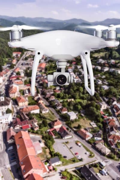
An aerial survey uses a drone with cameras and GPS sensors to map a property from above. The drone takes hundreds of photos and measures distances with great accuracy. These photos are then turned into a 3D model that shows slopes, corners, and surface changes.
For restaurant owners, that means:
- Seeing slope angles to check if patios are level and ADA-accessible.
- Measuring parking areas to make sure spots and walkways meet code.
- Checking drainage flow to stop water from pooling near customers.
The best part? It all happens fast. Drone surveys can be done in hours, not days, and give owners the data they need to make quick decisions.
Greenville’s MICHELIN makeover
In the week leading up to the awards, downtown Greenville looked like a construction zone in disguise. Workers were re-striping parking lots, putting up banners, and adjusting outdoor seating. For many of these small changes, permits and inspections were needed.
Greenville isn’t flat — small slopes and curbs can cause big problems for accessibility and safety. Restaurants that wanted to expand their patios or adjust entrances needed to prove their sites were compliant. That’s why several business owners turned to aerial surveying.
One manager shared that their drone scan caught a ramp that was slightly too steep — more than 5% slope, which failed ADA standards. They fixed it right away, avoiding inspection delays. Without that aerial survey, they might not have opened in time for the MICHELIN crowd.
A smart move for more than restaurants
This story isn’t just about fine dining. Greenville is growing fast, and every small property update matters — from paving a new driveway to adding outdoor lights. An aerial survey can help:
- Developers confirm elevation and drainage before pouring concrete.
- Contractors double-check site plans and access routes.
- Property managers keep clear visual records for insurance or lease reviews.
Because drones can cover large areas quickly and safely, they’re ideal for busy streets and uneven terrain. They also cost less than traditional surveying methods, making them a great choice for small business projects.
Why aerial surveys fit perfectly
Greenville’s mix of old buildings, hilly terrain, and new developments makes surveying tricky. Drones solve that problem. They’re:
- Fast – one flight can map a site in less than an hour.
- Accurate – GPS-based images capture every inch with precision.
- Safe – surveyors don’t need to cross roads or climb over uneven ground.
- Visual – business owners can see exactly what inspectors will look at.
For a city that’s growing as fast as Greenville, these quick scans make it easier to stay ahead of problems and keep projects moving smoothly.
Small detail, big payoff
For restaurant owners, a quick aerial survey meant less stress and more confidence. They knew their spaces were safe, accessible, and ready for guests. Surveyors got to showcase modern tools that make local businesses look professional and compliant.
It’s a win-win — Greenville looks amazing for the MICHELIN event, and surveyors prove that technology can make even last-minute fixes possible.
The bigger picture
Land surveying isn’t just about boundaries and blueprints anymore. It’s about helping communities grow smarter and faster. The MICHELIN event reminded everyone that details — like slope, drainage, and accessibility — matter just as much as what’s on the plate.
As more big events and new businesses come to Greenville, aerial surveys will keep playing a quiet but powerful role. They save time, reduce mistakes, and keep projects on track.
Final thoughts
The MICHELIN spotlight may fade after this week, but Greenville’s growth won’t. Every new patio, parking space, or sidewalk project will still need accuracy and speed. That’s where the aerial survey shines — giving business owners the right information, exactly when they need it.
If you’re planning upgrades to your restaurant, shop, or property, don’t wait until the last minute. See your site from above, fix problems early, and stay ready for whatever spotlight comes next.