Buying or selling a home often comes down to how well two people understand the same piece of land. The seller knows where they think the fence sits. The buyer assumes the driveway and side yard come with the deal. Small gaps like these can turn into real problems at the closing table.
A plat of survey closes those gaps. It puts the property on paper in a way both sides can read and trust.
Why Greenville Transactions Need Clear Property Information
Greenville has grown fast over the past decade. Older neighborhoods near downtown sit close to new subdivisions spreading toward the county edges. That mix means buyers and sellers rarely start with the same picture of a property.
Older lots often have fences, sheds or driveways that someone placed years ago without a current survey. Newer parcels can sit next to easements for drainage or utilities that a buyer never spots during a walkthrough. When the details stay fuzzy, both sides end up negotiating on guesses.
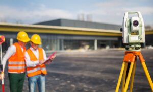
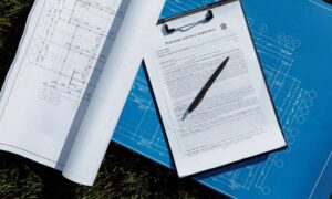
A plat of survey is a scaled drawing that a licensed land surveyor creates. It shows the property’s legal boundaries, the location of buildings, easements and features like fences or driveways as they sit on the ground. That clarity gives everyone a real starting point instead of assumptions.
How a Plat of Survey Creates a Shared Property Reference
Instead of each person describing the property from memory, a plat of survey gives them one measured document to point to. The buyer sees the exact boundary lines. The seller can confirm what the sale includes.
Agents, lenders and title companies read the same drawing too. When a question comes up about where the lot ends or whether a shed crosses the line, the answer sits on the plat rather than in a back-and-forth conversation. That shared reference cuts down on misunderstandings before they grow.
Property Details Buyers and Sellers Can Review Together
A plat of survey puts several details in front of both parties at once. Reviewing them together early gives everyone a chance to raise concerns before money changes hands. Common items on the drawing include:
- Boundary lines with measured dimensions
- The house, garage and any outbuildings and where they sit on the lot
- Recorded easements and rights-of-way for utilities or drainage
- Encroachments, such as a fence or driveway that crosses a property line
- Required setbacks from the street and side yards
- Access points and how the lot connects to the road
If a fence sits two feet inside the neighbor’s land, both sides find out now rather than after closing. Catching an issue like that early gives everyone room to negotiate a fix. It’s far easier to handle before the sale than after keys change hands.
Supporting Due Diligence During Real Estate Transactions
Due diligence is the checking phase before a sale closes. A plat of survey supports it by letting the title company compare the legal description in the deed against what the surveyor measured on site. In Greenville County, recorded plats and deeds sit in the public land records, so a current drawing can be checked against what’s already filed.
The plat can reveal easements that limit where a buyer builds later. It can flag an encroachment that needs a repair or a written agreement before closing. Both are far cheaper to solve while the deal is still open.
Survey needs vary by property type, lender, title company and the county handling the records. Some lenders ask for a current survey. Others accept an existing recorded plat. Buyers should confirm what’s required early, especially when a closing date, permit or planned construction depends on it.
How Survey Documentation Helps Reduce Transaction Confusion
Most transaction problems trace back to unclear information. A plat of survey gives buyers and sellers a common set of facts, which trims the back-and-forth and the last-minute surprises. When both sides trust the drawing, negotiations move faster and closings stay on schedule.
The plat also becomes a record the new owner keeps. Down the road it helps with a fence, an addition or a future sale. One accurate drawing at the start pays off long after the deal is done.
Frequently Asked Questions
What’s the difference between a plat of survey and a deed?
A deed is the legal document that transfers ownership and describes the property in words. A plat of survey is a scaled drawing that shows those same boundaries on the ground, along with structures and easements. Buyers often use both together, since the drawing makes the written description easier to picture.
Do I need a new plat of survey to sell my home?
Not always. Some sales move forward with an existing recorded plat, while certain lenders or title companies ask for a current one. Requirements depend on the lender, the title company and the property itself, so it helps to ask early.
How long does a plat of survey take to complete?
Timing depends on the property size, how complex the boundaries are and the surveyor’s current schedule. A straightforward residential lot usually takes less time than an irregular or wooded parcel. Ordering early keeps the survey from holding up your closing date.