If you’re planning a topographic survey this year, you might be surprised to hear that one of the biggest challenges isn’t equipment or permits—it’s ticks. Survey crews across the country have been sharing frustrations online, with one Reddit thread even calling 2025 “the year of the tick.” Add in the heat of a South Carolina summer, and fieldwork that usually runs smoothly can suddenly slow down.
So what does that mean for property owners, builders, and developers who need surveys done on time?
Why Ticks Are a Bigger Issue in 2025
Fieldwork has always had its risks, but this year is different. According to national health reports, emergency visits for tick bites are at their highest since 2019. Survey crews, who spend hours walking through brush and wooded areas, are often the first to feel the impact.
Ticks aren’t just annoying. They can carry diseases like Lyme or Rocky Mountain spotted fever. In South Carolina, the Department of Public Health warns that multiple types of ticks thrive in our climate. That means more protective gear, more breaks to check for bites, and in some cases, fewer crew members willing to work in high-risk conditions.
When crews slow down, survey timelines stretch out. That can be frustrating if you’re waiting on a topo map to submit with permits, design plans, or financing paperwork.
Why Topographic Surveys Are Affected the Most
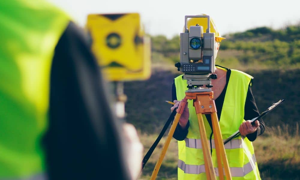
Not every survey type involves trudging through thick brush, but topographic surveys often do. Crews need to map slopes, elevations, and surface features that are usually far from paved areas. That means hiking across lots filled with tall grass, creek banks, and tree lines—all prime tick territory.
In Greenville, many residential and commercial properties include wooded edges or rolling terrain. A topographic survey requires clear data across the entire site, so surveyors can’t skip those harder-to-reach spots. Instead, they gear up with long sleeves, insect spray, and sometimes tick-proof clothing. The result: slower progress, more caution, and sometimes multiple trips.
Greenville’s Local Risk Factors
Our region makes survey work even trickier during peak tick season. Warm temperatures stretch well into fall, and heavy rainfall can leave grass and brush thick and damp. That’s exactly the environment ticks love.
Crews working near Paris Mountain, the Reedy River, or any of Greenville’s many wooded subdivisions face a higher chance of exposure. Combine that with heat advisories, and surveyors must balance safety with productivity. The last thing you want is a rushed job that misses critical site details—or worse, sidelined staff who can’t return to finish the work.
What This Means for Your Project
If you’re a property owner or developer, delays in fieldwork can ripple through your timeline. Topographic surveys often serve as the foundation for design, drainage planning, and permitting. When crews need more time, engineers and contractors can’t move forward as quickly.
That doesn’t mean projects stall completely. It does mean you should build in realistic expectations, especially during summer and early fall. A survey that might normally take a few days could stretch longer. Knowing this upfront helps you plan around submission deadlines and avoid last-minute stress.
How You Can Help Crews Stay on Schedule

The good news? Property owners can play a part in keeping surveys efficient. A few small steps make a big difference:
- Mow tall grass in areas where surveyors will need access. Even partial clearing reduces tick exposure.
- Provide easy entry to the site. Open gates, mark paths, and remove obstacles where possible.
- Secure pets before the crew arrives. Dogs and outdoor animals often carry ticks, which can spread to workers.
- Stay flexible on timing. Early morning or cooler evening hours are safer for crews and can reduce delays.
These efforts show you value the crew’s safety and help them finish your topographic survey faster and more accurately.
The Bigger Picture: Data That Proves the Problem
You might wonder if ticks are really that serious. Health data says yes. CBS recently reported that tick-related ER visits in 2025 are at record levels nationwide, with cases peaking earlier than usual. That trend matches what survey crews are sharing online: field conditions are tougher this year than most.
When national health reports and local experiences line up, it’s clear this isn’t just a passing complaint—it’s a real factor in project planning. Recognizing it helps everyone adjust expectations and prepare smarter.
Looking Ahead: Smarter Surveys in Challenging Conditions
Challenges like this also push the industry toward creative solutions. In some cases, drones are helping with overhead mapping, though they can’t replace the ground-level accuracy of a traditional topographic survey. Still, combining new tools with smart site prep is one way surveyors are working to stay efficient.
For clients, the message is clear: survey crews are adapting, but the environment has changed. Supporting them with simple site prep and realistic scheduling is the fastest way to keep your project moving.
Conclusion:
Ticks and heat may seem like small issues, but for survey crews, they add up to real delays. If you’re planning a topographic survey, now is the time to think ahead. A safe crew is a productive crew, and a prepared property helps keep everyone on schedule.
Instead of waiting until deadlines are tight, take steps now: clear grass, mark access points, and connect with survey experts for topographic mapping to plan your project around the season. By doing so, you’ll get accurate results, fewer reschedules, and peace of mind knowing your project won’t get stuck in the weeds—literally.