If you own property or plan to buy a home, chances are you’ve heard about boundary survey disputes. These disagreements happen when neighbors argue over where one property ends and another begins. A boundary survey is supposed to show the exact lines of your land, but sometimes, things get messy. People say, “Your survey is wrong!” and suddenly, what seemed clear becomes confusing and stressful.
What is a Boundary Survey and Why Does It Matter?
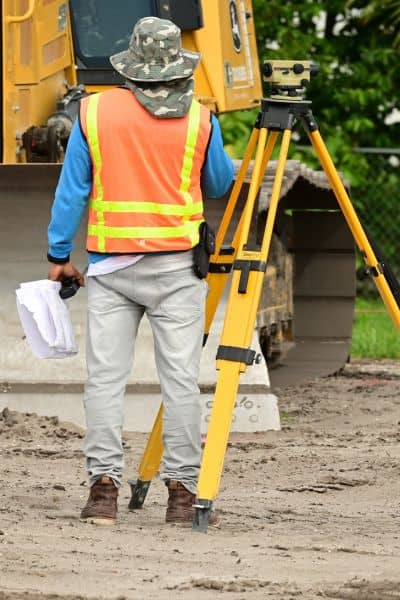
First, let’s get clear on what a boundary survey is. Boundary surveys are a special type of land survey that determine the exact edges of your property. Surveyors look at maps, deeds, and physical markers—such as stakes or pins in the ground—to figure out where your property starts and ends.
This survey matters a lot because it helps avoid disputes about fences, trees, buildings, or other things that might cross property lines. It also protects your investment. When you buy a house, a boundary survey shows you what you’re really getting.
Why Are Boundary Survey Disputes Spiraling in Greenville?
Greenville is growing fast. New homes, businesses, and roads pop up all the time. With this growth, more land changes hands and boundaries shift. This rapid change is one big reason why boundary survey disputes are on the rise here.
Also, Greenville recently approved a large number of annexations—meaning the city is officially expanding its borders. When annexations happen, property lines can become unclear. Sometimes the old markers are gone or moved, and records don’t always match what’s on the ground. This mix-up causes confusion.
Another issue is old or conflicting property records. Some deeds use old descriptions like “from the big oak tree to the stone wall,” but those markers might not exist anymore. Surveyors have to guess or interpret these old clues, which can lead to different results.
Plus, many surveys are rushed. Surveyors sometimes face tight deadlines or heavy workloads. This pressure can cause mistakes or missed details like hidden utilities or trees, which can later cause neighbors to question the survey’s accuracy.
Common Frustrations From Surveyors and Property Owners
Surveyors themselves share frustrations. Many feel stretched too thin, juggling many jobs with little time to double-check their work. Sometimes, they also struggle with outdated technology or regulations that don’t keep up with new methods like drones or 3D scanning.
Property owners, on the other hand, often complain that surveyors don’t communicate well. Maybe the survey didn’t include something important, or the report wasn’t clear. This lack of clear info can spark arguments between neighbors and lead to mistrust.
Also, permit delays or local government red tape add to the problem. If a survey needs approval or special permits, any delay slows down projects and increases tension between neighbors waiting for answers.
What to Do If You’re Caught in a Boundary Survey Dispute
Finding yourself in a boundary dispute can be scary. But don’t panic. There are clear steps you can take to protect your property and your peace of mind.

First, carefully review your boundary survey and any related documents. Make sure you understand what was surveyed and what the markers show. Next, talk to your surveyor. Ask questions about the methods used and any areas that seem unclear. A good surveyor will explain their process and be open to checking problem areas again. Then, communicate with your neighbor calmly. Listen to their concerns and share your own. Sometimes, disputes come from misunderstandings or assumptions that can be fixed with a conversation.
If talking doesn’t help, use local resources.Property records office or planning department can provide official maps or previous surveys. They might also suggest mediation services to help you and your neighbor work things out without going to court.
If the dispute continues, consider legal advice. Sometimes, the courts need to decide property lines. But remember, legal battles can be expensive and stressful, so use this as a last resort.
Finally, if your current survey feels unreliable, consider hiring a licensed land surveyor for a new or more detailed survey, like an ALTA/land title survey. This kind of survey provides extra details, including easements and rights of way, which can help clarify complicated boundaries.
How to Prevent Boundary Survey Disputes
Prevention is always better than cure. You can take steps now to avoid boundary disputes before they start.
Always hire a licensed, experienced local land surveyor. Someone familiar with unique landscapes and regulations will do a better job.
Ask for a thorough boundary survey that includes monument searches and utility locates. Make sure your surveyor clearly marks boundaries with physical markers.
Understand your property’s deed and history before buying or building. Ask for previous surveys and research the property lines.
Stay informed about local developments, zoning changes, or annexations that might affect your property lines.
Finally, keep good communication with your neighbors. Respect their property, share plans if you want to build a fence or add structures near boundaries, and address concerns early.
Conclusion
Boundary survey disputes are rising, fueled by fast growth, old records, and sometimes rushed surveys. But understanding what a boundary survey is, why disputes happen, and how to handle them can keep you safe.
If you find yourself hearing, “Your survey is wrong!” remember that most disputes can be solved with good communication, professional help, and patience.
For peace of mind, work with a licensed land surveyor you trust. Whether you’re buying a home, building a fence, or selling property, a solid boundary survey protects your investment and your neighborhood peace.


