How to Find Someone to Survey Your Property Boundary Correctly

There are different reasons why somebody would need boundary surveying in their property. Often, this type of surveying is done if the owner of the property wants to legally place an item on the property such as a new structure or a fence.

A Licensed Land Surveyor

When hiring a land surveyor, you have to make sure that he is duly licensed by your state. A “licensed” land surveyor means he was able to complete his studies, passed all exams and is certified to perform specific types of land surveys.

Hiring a licensed land surveyor is especially important if there is a dispute over a certain area of a property as the court would be asking for the current boundary survey result as well as testimony from a licensed land surveyor. With this being said, you also have to make sure that the surveyor you’re going to hire can also stand as an expert witness in court.

Looking for a Licensed Land Surveyor
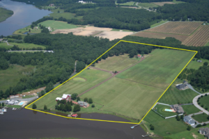
If your property has been surveyed before, it would be easier for you to contact that land surveyor again. This is the best option for several reasons; he already has all information about your property, making it easier for him to perform a new type of survey.

You can typically find your land surveyor’s information on the survey result given to you (if you’ve bought the property from somebody, for instance) or the result given to you by the surveyor himself.

If you don’t have the survey drawing, you can also check the markers put in place by the surveyor during the last survey done on your property. These markers, which looks like iron pegs or pipes, should have the surveyor’s license number/ name on it. You can use this information to find the surveyor online.

If you can’t find the surveyor who worked on your property before, or if the property has never been surveyed, you should easily find a land surveyor in your area (for a land surveyor in the South Carolina area, click here).

Important Points to Remember when Hiring an ALTA Surveyor

  • As mentioned, make sure that he or she is a licensed land surveyor.
  • He or she should have experience in performing alta boundary surveys. If you’re going to pay somebody, you’d rather have someone who has done it before, right?
  • Look for someone easy to talk to. Communication is very important when hiring a land surveyor. You see, surveying is more of an art than a science – this is why land surveying results vary. It’s important that your surveyor understand why you’re having the survey, what you’re going to use the results for and how soon you’ll be needing the results.
author avatar
Surveyor

More Posts

Large road sinkhole showing collapsed pavement and exposed soil layers, highlighting the need for a construction staking survey
land surveying
Surveyor

What Sinkholes Teach About a Construction Staking Survey

Woodruff Road is known for heavy traffic, but this time it wasn’t just cars slowing things down. A water pipe burst and caused a large sinkhole near one of Greenville’s busiest intersections. The road flooded, lanes closed, and drivers got stuck for hours. Videos of the mess spread fast online.

Read More »
Land surveyor using total station to measure property boundaries during an ALTA Land Title Survey
alta survey
Surveyor

When Boundaries Blur: The ALTA Land Title Survey Solution

In Greenville, the recent land transfer debate showed why an alta land title survey matters more than ever. When a large property near Arcadia Drive was moved between the city and county, confusion followed. Neighbors weren’t sure where the real property lines were, and questions about “who owns what” spread

Read More »
Professional drone surveying an active construction site with cranes and workers, collecting aerial data for engineering and land surveying projects.
land surveying
Surveyor

Drone Surveying Keeps Projects on Track

Greenville has had another wild week. Storms rolled through, power flickered, and satellite signals went haywire—just when survey crews were trying to finish their work. For many land surveyors, this kind of weather means waiting it out. Wet soil, unstable GPS connections, and broken power lines can stop projects fast.

Read More »
Land surveyor using tripod equipment during a flood elevation survey at a residential property site
flood damage
Surveyor

Why You Need a Fresh Flood Elevation Survey Now

If you live in Greenville, you’ve probably seen plenty of news about growth, new construction, and changing flood maps. But the latest update from the U.S. Geological Survey (USGS) adds a new layer of urgency. Just this week, the agency released a fresh landslide hazard brief for the Southern Appalachians—right

Read More »
Construction survey stakes and bulldozer preparing a new subdivision site with homes being built
construction
Surveyor

Why Every Subdivision Needs a Construction Survey First

Greenville is growing fast. New subdivisions seem to appear every month, and neighbors are starting to notice the traffic, the drainage, and the trees coming down. When a developer gets approval for a new neighborhood, the excitement begins, but so do the concerns. This is where a construction survey makes

Read More »
Two neighbors arguing over a wooden fence line, illustrating a boundary survey dispute between property owners.
boundary surveying
Surveyor

Boundary Survey Disputes: What To Do When They Go Wrong

If you own property or plan to buy a home, chances are you’ve heard about boundary survey disputes. These disagreements happen when neighbors argue over where one property ends and another begins. A boundary survey is supposed to show the exact lines of your land, but sometimes, things get messy.

Read More »