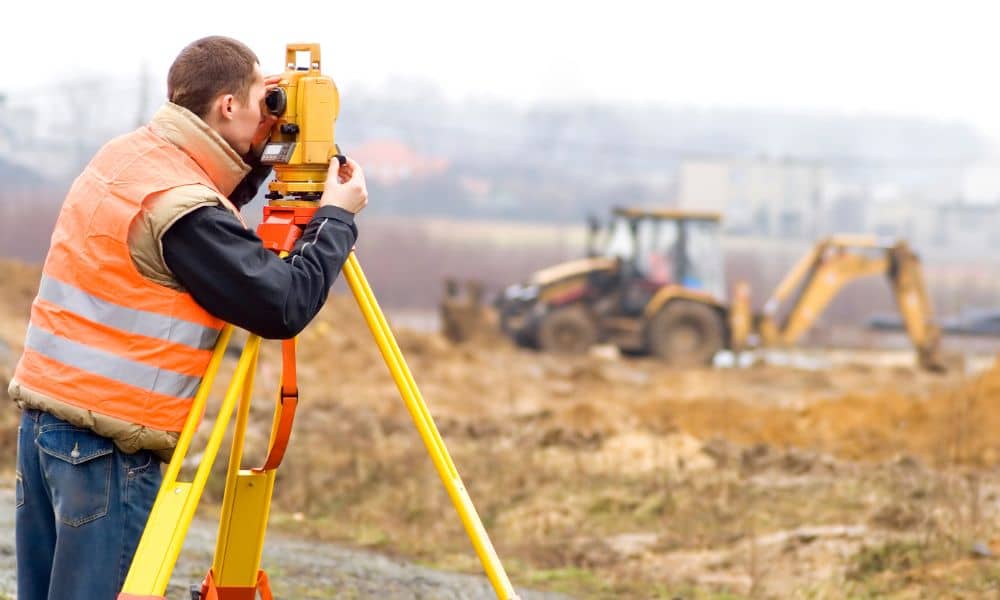
If you’re thinking about starting a new construction or redevelopment project, here’s the thing: you can’t build on guesswork. You need to know your land inside and out. That’s exactly what a topographic survey does.
It’s like getting a detailed map of everything that’s already on the land—hills, valleys, trees, roads, and even buildings. With this information, you can plan smartly, avoid costly mistakes, and save yourself a lot of headaches down the road.
Even if your project isn’t in Greenville, these ideas apply everywhere. Greenville’s projects, like the Gateway Project, Greenville County Square, and City Hall redevelopment, are perfect examples of how a good survey sets the foundation for success.
What’s a Topographic Survey, Anyway?
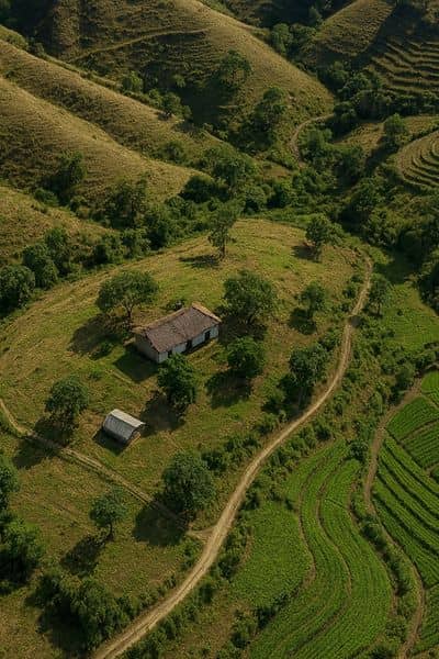
Simply put, a topographic survey shows the shape and features of the land. It includes:
- Elevation changes, slopes, and contours
- Trees, vegetation, and natural features
- Roads, sidewalks, and existing structures
- Drainage patterns and waterways
Surveyors use drones, GPS, and lasers called LiDAR to create super-detailed, 3D maps. Unlike a regular boundary survey that just marks property lines, a topographic survey shows how the land rises and falls. That’s why it’s so important for planning.
Knowing this upfront helps you place buildings, roads, and utilities where they make sense. It also shows where water might collect, where soil could be tricky, and where construction challenges could arise.
Why You Need a Topographic Survey
You might be wondering, “Do I really need this?” The answer is yes—because understanding your land from the start makes everything easier.
A topographic survey is a key part of land surveying services that shows the terrain in detail. With this information, you can plan smart, avoid surprises, and keep your project on track.
1. Plan Smarter, Build Better
When you know your land’s details, you can plan smarter. You’ll know where to put buildings, roads, and pipes so they fit naturally with the terrain. That means fewer redesigns and less wasted time.
For example, Greenville County Square used a survey to figure out how homes, offices, and shops would fit the land without causing drainage problems. Smart planning made construction smoother and more efficient.
2. Spot Problems Early
Nothing derails a project faster than surprises. Low spots that flood, slopes that are too steep, or weak soil can ruin a timeline and budget. A topographic survey shows these issues before construction begins, giving you time to fix them.
The Gateway Project, for instance, needed precise elevation data to ensure a 29-story building would stand safely. Without the survey, there could have been serious problems.
3. Stay on the Right Side of Rules
Cities have rules to protect people, buildings, and the environment. A survey gives officials the information they need to approve your plans quickly. That keeps your project on track and avoids costly delays.
It also helps you preserve natural features like trees, wetlands, and green spaces. That’s a win-win: your project stays legal, and your community stays happy.
4. Save Time and Money
It might seem like a survey is just another expense—but it’s actually an investment. By knowing the land’s details upfront, you avoid surprises, reduce waste, and finish your project on time. In most cases, a survey pays for itself many times over.
Greenville Shows How Surveys Make Projects Work
Even if your project is elsewhere, Greenville offers great lessons.
- Gateway Project: Needed precise elevation data to safely support a 29-story building.
- Greenville County Square: Surveying helped place buildings and parking lots while avoiding flooding.
- City Hall Redevelopment: Survey data helped integrate new construction with existing structures and public spaces.
These examples prove it: a survey isn’t just paperwork—it’s your guide to a successful build.
Technology Makes Surveys Faster and Easier

Today, surveys are faster and more accurate thanks to drones and LiDAR. These tools create 3D maps that capture every slope, tree, and structure.
Drones can cover large areas in hours, and LiDAR produces highly detailed elevation data. Together, they help planners make confident decisions without delays. Plus, digital data allows architects, engineers, and city officials to collaborate seamlessly, even if they’re miles apart.
Picking the Right Survey Company
Not every surveyor delivers the same quality. Look for:
- Experience with topographic surveys
- Use of modern tools like drones and LiDAR
- Understanding of local regulations and environmental concerns
- A proven track record of supporting redevelopment projects
A good surveyor doesn’t just map the land—they provide insights that save you time, money, and stress.
Quick Tips to Maximize Your Survey
Here’s how to make the most of your topographic survey:
- Order it early: Don’t wait until your plans are final.
- Update if needed: Land can change—especially on long projects.
- Use the data: Incorporate survey findings into site plans, drainage systems, and building layouts.
- Share widely: Architects, engineers, and officials should all see the data for smoother approvals.
Follow these steps, and your project will run much more smoothly.
Bottom Line
A topographic survey is more than a map. It’s a tool that guides planning, highlights risks, ensures compliance, and saves time and money.
Even if you’re not building in Greenville, the lessons are universal. The Gateway Project and County Square show how a survey can prevent mistakes and keep complex projects on track.
So, if you’re starting a redevelopment or construction project, start with a topographic survey. It’s the first step to building with confidence, avoiding surprises, and creating a project that fits the land perfectly.
