Land Surveying: Estimating the Cost

Land surveying, in short, is the science and art of establishing or re-establishing property corners, property lines and/or boundaries. There are different reasons why someone wants a lot surveyed.

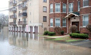
Essentially the most common is to check if a piece of land is vulnerable to flooding, to subdivide a property to sell or to determine if there are any encroachments. This may happen if a neighbor disputes that you are using a piece of his lot or vice versa (for more on this, go here).

The Cost of Land Surveying

If you need to have a piece of land surveyed, the first thing that will come to mind is “how much will it cost?”There are plenty of factors determining exactly how much land surveying for your land would cost.

The fact that this type of service must be carried out by an expert contributes a great deal to the overall cost of the service, but choosing a non-professional to survey your land is dangerous and possibly illegal for the non-professional. Because of this you have to take a good look around before settling with a surveying company.

If you must work within a particular budget, discuss this with the surveyor up-front. Very often he may be able to offer cost saving steps to get the work you need done within these cost limits. The form of the land must also be looked into. A square or even a rectangle piece of land is somewhat easier to survey than an odd shaped parcel, or one with many different sides.

With the latter, the surveyor would have to take more time in surveying the curves as well as the bends which means the cost of the service would go higher.

The overall measurements the land is also key factor here. Understand that the cost of land surveying is normally proportionate to the time and effort that the land surveyor would spend on the project. If the land that you’re having surveyed isn’t accessible, or has thick vegetation, then the total price of the survey might go higher.

This is true of the varying weather conditions that might impact the work. Surveying in warm weather is somewhat slower to keep from putting the crew members in danger. Also, most surveying can’t be done in the rain.

When requesting for an estimate, bear in mind that surveyors base the estimate on expected conditions at the site. These conditions could change, bringing about additional costs. Always ask about these potential additional cost scenarios.

All that being said, competitive prices are also to be expected, this is why we recommend deciding on a surveyor based upon his experience and reputation rather than on the price he writes on a piece of paper. Usually it is better to invest a good amount of money on a survey that’s well-done rather than choose a company with a very “affordable” price but have the survey repeated because the results were wrong.

To sum it up, you should always discuss the expenses of the survey before you decide to ask the surveyor to start his work. It’s also wise to receive a contract that lets you know what is expected of the land surveyor. This is one of the most important steps in getting your land surveyed.

author avatar
Surveyor

More Posts

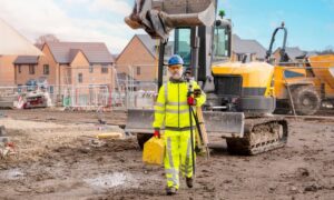
Land surveyor in safety gear walking across a muddy construction site after heavy rain, representing the importance of an ALTA Title Survey after storms
alta survey
Surveyor

Why Storms Make an ALTA Title Survey Essential

Greenville saw heavy storms last weekend that brought flash floods, strong winds, and muddy yards. What many homeowners and buyers don’t realize is that this kind of weather can quietly change how a property is marked, measured, and even valued. That’s where an ALTA Title Survey comes in—it’s a detailed

Read More »
Aerial view of a restaurant patio captured by a drone during an aerial survey before a major event
land surveying
Surveyor

How a Last-Minute Aerial Survey Saved Restaurants

Downtown Greenville is full of excitement this week. The MICHELIN Guide American South Awards are happening at the Peace Center, and restaurants all over the city are getting ready. They’re repainting curbs, fixing patios, and adding tables for guests. But what most people don’t see is that many restaurants relied

Read More »
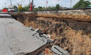
Large road sinkhole showing collapsed pavement and exposed soil layers, highlighting the need for a construction staking survey
land surveying
Surveyor

What Sinkholes Teach About a Construction Staking Survey

Woodruff Road is known for heavy traffic, but this time it wasn’t just cars slowing things down. A water pipe burst and caused a large sinkhole near one of Greenville’s busiest intersections. The road flooded, lanes closed, and drivers got stuck for hours. Videos of the mess spread fast online.

Read More »
Land surveyor using total station to measure property boundaries during an ALTA Land Title Survey
alta survey
Surveyor

When Boundaries Blur: The ALTA Land Title Survey Solution

In Greenville, the recent land transfer debate showed why an alta land title survey matters more than ever. When a large property near Arcadia Drive was moved between the city and county, confusion followed. Neighbors weren’t sure where the real property lines were, and questions about “who owns what” spread

Read More »
Professional drone surveying an active construction site with cranes and workers, collecting aerial data for engineering and land surveying projects.
land surveying
Surveyor

Drone Surveying Keeps Projects on Track

Greenville has had another wild week. Storms rolled through, power flickered, and satellite signals went haywire—just when survey crews were trying to finish their work. For many land surveyors, this kind of weather means waiting it out. Wet soil, unstable GPS connections, and broken power lines can stop projects fast.

Read More »
Land surveyor using tripod equipment during a flood elevation survey at a residential property site
flood damage
Surveyor

Why You Need a Fresh Flood Elevation Survey Now

If you live in Greenville, you’ve probably seen plenty of news about growth, new construction, and changing flood maps. But the latest update from the U.S. Geological Survey (USGS) adds a new layer of urgency. Just this week, the agency released a fresh landslide hazard brief for the Southern Appalachians—right

Read More »