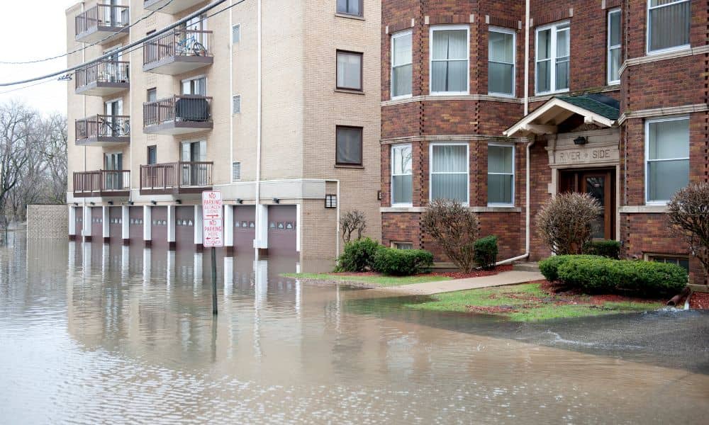
South Carolina homeowners are facing new flood insurance challenges, and many are feeling caught off guard. In the middle of all this, the elevation certificate has suddenly become one of the most important documents in the state. Over the past few weeks, changes in flood maps, insurance rules, and risk models have created confusion, stress, and financial surprises. Some homeowners are seeing their premiums jump. Others are being asked to get new inspections before they can renew their policies. And more lenders are requesting updated elevation data before approving a mortgage.
This shift sounds complicated, but the impact is simple: flood risk is being recalculated, and people are paying the price.
Why This Change Is Happening Now
To start, South Carolina flood data is being updated county by county. FEMA recently introduced major changes to how it evaluates risk across the state. New maps are rolling out, and cities and counties are sharing updated hazard information. Insurance companies are responding quickly because flood risk determines policy pricing.
These changes are designed to make premiums more accurate. However, accuracy sometimes means higher costs.
At the same time, lenders rely on FEMA maps to decide whether a home needs flood insurance. When the maps change, their rules change too. If a property falls inside a higher-risk zone, banks can demand insurance almost immediately.
Naturally, this creates pressure. It also explains why elevation certificates are suddenly being rushed.
Why Greenville Is Feeling the Impact
We are not seeing these changes only in coastal cities. Greenville is affected too. The map updates are reaching inland. That surprises many homeowners, but recent storms have shown how unpredictable local flooding can be.
Greenville has rolling hills, steep slopes, and several waterways running through neighborhoods. When FEMA updates base flood elevations, local flood zones shift. A house that seemed safe last year might now be considered high risk.
In fact, Greenville residents are already seeing the following:
- new quotes showing large increases
- banks asking for insurance to protect their loan
- insurance agents requesting updated elevation data
- closing delays due to missing documentation
This is why many homeowners are scrambling to understand what changed and why.
Why the Elevation Certificate Matters Right Now

An elevation certificate proves how high your home sits compared to the expected flood level near your property. Insurance companies use it to decide how dangerous your location is. That one piece of paper can change your yearly premium by thousands of dollars.
It tells insurers key things like:
- where water would likely reach
- how your house stands compared to nearby terrain
- if floodwaters would reach the foundation
- if your structure sits above or below the base flood elevation
When insurance companies don’t have this data, they assume the worst. That usually leads to higher bills. If they DO have the document, they often reduce the cost.
This is why people order elevation certificates during:
- home buying
- refinancing
- policy renewal
- construction planning
- property improvements
In many cases, the document protects both the buyer and the bank.
How the Insurance Shake-Up Is Affecting Homeowners Emotionally
It’s not just a financial situation.
It’s emotional.
Imagine opening your email and discovering: Your flood insurance is doubling. Or worse, your renewal has been denied. That is happening right now.
People feel confused, frustrated, even powerless. Nobody likes unknowns around their home. Nobody wants to feel like their house is worth less or suddenly unsafe. And nobody wants surprise costs while interest rates are already high. In moments like that, clarity matters. An elevation certificate gives clarity. It shows your actual risk, not guessed risk.
How Homeowners Can Respond
You don’t have to panic. You only need to stay informed.
First, understand that flood insurance is about data. When data changes, risk changes. When risk changes, premiums change.
Second, look at your property with fresh eyes. Even if you never flooded before, the numbers matter more than past experience.
Third, contact your insurance agent and ask a simple question:
“Did anything change in my flood zone recently?”
If the answer is yes, then you’ll likely need stronger documentation.
That documentation is usually the elevation certificate.
How an Elevation Certificate Can Save You Money
Many homeowners assume ordering one is only a cost.
Think of it as leverage.
It can help you:
- lower your premium based on accurate elevation
- challenge incorrect flood zone placement
- qualify for better insurance
- unlock more options during closing
- avoid paying for insurance you don’t need
I have seen homeowners save thousands per year because their elevated foundation was recorded properly. I have also seen buyers avoid flood policies completely because the certificate proved they were above the hazard line.
That kind of result matters.
What Happens If You Don’t Get One
If your lender wants one, closing stops.
If your insurance wants one, premium jumps.
If FEMA updates your zone, confusion rises.
Ignoring the issue is the worst financial move someone can make at this moment.
Being proactive is always cheaper than being reactive.
Greenville Is Not Alone
Columbia is seeing this. Charleston is seeing this. York County is seeing this. Small towns and large cities are both seeing this.
Across the Southeast, we are entering a new era of flood risk understanding.
Greenville just happens to be at a key turning point.
What You Should Do Next
Take a deep breath. Then take action. Call your insurance agent and ask what changed. Look up your property on the FEMA flood map viewer. If you still feel unsure about your actual risk, speaking with land surveyors in my area can help you understand your home’s true elevation and what your options are. You don’t need to panic. You just need the right information. Better data always leads to better choices, and that is exactly what an elevation certificate provides.
Final Thought
South Carolina is changing how it understands flood risk. Because of this, homeowners are facing new expectations, new insurance pressures, and new documentation requirements.
And while the transition feels stressful, this is also a chance to get ahead of the curve. If you act early, you can protect your finances, your home, and your peace of mind.
In a time of uncertainty, clarity is the most valuable asset you can have.
And clarity begins with knowing your true elevation.


