
If you live in Greenville, you’ve probably seen plenty of news about growth, new construction, and changing flood maps. But the latest update from the U.S. Geological Survey (USGS) adds a new layer of urgency. Just this week, the agency released a fresh landslide hazard brief for the Southern Appalachians—right as the region marks one year since Tropical Storm Helene brought deadly floods and slides. For homeowners, it’s a reminder that risks don’t always stay the same. That’s where a flood elevation survey becomes critical.
What the USGS Report Really Means for Greenville
The USGS report didn’t just look at floods; it focused on how landslides and heavy rainfall work together to put entire neighborhoods at risk. Greenville sits at the foothills of the Blue Ridge Mountains, with winding rivers and steep grades that make water flow unpredictable. When a storm like Helene hits, it’s not just rising rivers that cause damage—it’s also unstable slopes and shifting ground.
For residents, this means one thing: being outside a FEMA flood zone is no longer a guarantee of safety. Landslide-prone slopes can redirect water in surprising ways, and creeks like the Reedy and the Saluda can overflow even if your home isn’t on the official floodplain map. The new science confirms what many homeowners already suspect—maps tell part of the story, but they don’t tell it all.
Why a Fresh Flood Elevation Survey Matters Right Now
Flood maps change, and hazard studies keep evolving. If your elevation data is old, it might not reflect today’s reality. A fresh flood elevation survey gives you site-specific numbers on how your property sits compared to base flood elevations. That means you’ll know if your home is at risk or if you’re paying too much for flood insurance.
For example, some Greenville neighborhoods saw changes after the City Flood Study layer went live in March 2024. Countywide flood maps were last updated in 2021. Put that together with the USGS landslide brief, and you’ve got plenty of reasons to recheck your property’s true elevation.
It’s not just about insurance, though. Lenders often require updated elevation information during refinancing or new loans. If you wait until closing day, you could face delays or unexpected costs. Getting the survey now means you control the timeline.
Floods and Landslides: A One-Two Punch

One of the biggest takeaways from the USGS update is how flooding and landslides overlap. In Greenville, where development is pushing into hillsides, that overlap matters more than ever. Picture a slope above your property loosening during heavy rain. Even if your home isn’t “in the flood zone,” redirected water and debris could still cause major damage.
That’s why relying only on FEMA maps or citywide studies can give a false sense of security. A flood elevation survey cuts through the guesswork by showing exactly where your foundation sits compared to known flood levels. Combine that with landslide hazard data, and you have a clearer view of your property’s real exposure.
How Homeowners Can Use This Data
The best part of a flood elevation survey is how practical it is. Once you have the results, you can take action in ways that matter:
- Challenge insurance costs. If your survey proves you’re above base flood elevation, you could reduce or even remove flood insurance requirements.
- Plan smarter improvements. Adding a deck, expanding a basement, or moving HVAC units? Elevation data shows what’s safe and what could backfire during a storm.
- Protect resale value. Buyers are wary of risk. A recent survey gives them confidence that your property is safe—and helps you close faster.
- Stay ahead of lenders. If you’re refinancing or buying, having the survey ready keeps the process smooth.
When paired with online flood study maps, the SC Flood Impact portal, and USGS hazard dashboards, the survey becomes even more powerful. You’ll see not just your lot, but how your property fits into the bigger picture of water flow and hillside stability.
Real-Life Scenarios in Greenville
Imagine a family buying near the Reedy River. On paper, the property looks fine. But a flood elevation survey reveals the crawlspace sits just below base flood elevation. That small detail could mean higher premiums—or worse, flood damage after the next storm. With the survey in hand, the buyers can either negotiate repairs, adjust their insurance, or walk away from a risky deal.
Or take a homeowner with a hillside lot. Landslide hazard maps now show their slope is unstable after heavy rainfall. A flood elevation survey gives them the measurements they need to install proper drainage and protect their foundation before problems start.
These aren’t “maybe” situations—they’re real decisions happening across Upstate neighborhoods today.
The Cost of Waiting
Some homeowners put off ordering a survey because they think maps are enough. But the cost of waiting can be steep. Higher insurance premiums, delayed closings, and unexpected flood repairs all add up. A flood elevation survey is far less expensive than a year of extra premiums—or the price of water damage after the next storm.
More importantly, time matters. Hazard studies and city maps will continue to update, and lenders will keep adjusting their requirements. Acting now puts you ahead of the curve instead of scrambling to catch up.
Taking the Next Step
If you live near rivers, creeks, or hillsides, the USGS landslide hazard report is a wake-up call. Don’t assume last year’s numbers still protect you. A fresh flood elevation survey can show you where you truly stand and help you make smarter decisions about insurance, safety, and property value.
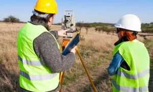
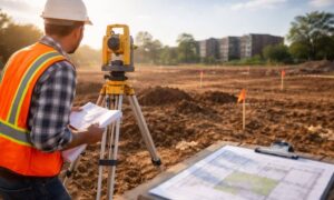
Local licensed surveyors know the terrain, the regulations, and the floodplain rules specific. With their help, you can go beyond the broad maps and get data that applies directly to your home.
Conclusion
The USGS report reminds us that nature doesn’t stick to neat lines on a map. In Greenville, where floods and landslides can strike together, being proactive is the smartest move you can make. Think of a flood elevation survey as your shield—lower costs, safer property, and peace of mind all in one step.
Don’t wait for the next storm to reveal the risks. Order the survey, understand your property, and stay one step ahead.